Visitors to Vancouver often assume that the Rocky Mountains should be right on their hotel doorstep. In fact, they’re about 500 miles away.
Between the Coast of British Columbia and the Rockies lie three mountain ranges and an intermontane plateau that includes the region known as the Cariboo. Mountains generally make for great motorcycling roads, and British Columbia, Canada’s most mountainous province, is no exception. The flip side is that mountains make their own weather too!
Fortunately, the sky is blue when I head out of Vancouver. The Fraser River’s fertile delta spreads across a 50-mile gap in the Coast Mountains behind me. I’m heading east along the Fraser Valley on BC’s Highway 7. The Fraser River is named for Northwest Company explorer Simon Fraser, who traced its course to the Pacific Ocean in 1808. The mountains squeeze closer together on either side as I roll past flat fields of grain and berry bushes. To the south, 11,000ft Mt. Baker’s snowy peak gleams in the sunlight. I’ve rarely seen it free of clouds, so that’s a good sign for the weather to come.

At the eastern end of the Fraser Valley is the aptly named town of Hope, once the gateway to the goldfields. The Fraser turns west after flowing south down the center of the province, so I’m tracking it back upstream. My route is the Trans-Canada, Highway 1, once the “main” road east. Until the 1980s, that is, when a new highway, the Coquihalla, established a faster route through the Cascades — more direct, though less scenic. Canada Highway 1 still faithfully follows the river valleys inland at a steadier pace–perfect for the Commando.
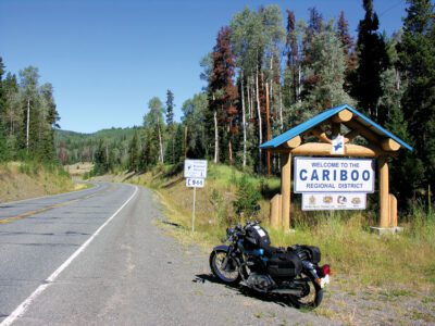
I’m riding my 1974 850 Roadster, which in spite of being almost 50 years old, is perfectly happy rumbling along at the speed limit. Over the years I’ve refined it with modern components where appropriate — like electronic ignition, improved engine breathing to reduce oil leaks, and better brakes.
I’m now following the Gold Rush Trail north. As in many other parts of North America, prospectors opened up the interior of British Columbia, though fur traders of the Hudson Bay and Northwest Companies had already established a number of fortress outposts. Early gold diggers followed the Fraser River north to the goldfields 300-odd miles north on a trail “utterly impassable for any animal but a man, a goat, or a dog,” according to one contemporary report. Thankfully, the trail is now paved and a little wider because my Norton is no mountain goat. My plan is to take three days to ride to and around B.C.’s southern interior and the Cariboo.
Rivers
The Fraser cuts a deep gorge through the mountains with narrow shoulders on either side. The highway and the railroad lines cling to the banks, with the rail line frequently crossing iron truss bridges and disappearing into tunnels. Roadside pullouts offer splendid views over the tortuous railroad line and the rushing river far below. I turn off the highway and ride into the village of Lytton. Sadly, Lytton was directly in the line of a aggressive wildfire in 2021, and the village burned to the ground. At time of writing, the state of emergency has only just been lifted. The town’s other claim to fame is that it overlooks the confluence of the Fraser and Thompson Rivers; I park at the overlook and watch paddlers negotiate the currents as the crystal-clear Thompson merges with the murky, silt-laden Fraser.

From Lytton, the Gold Rush Trail heads north along the Fraser to Lillooet, but I’m going east on 1, following the Thompson upstream, while the road matches the Thompson’s rambling route under steep cliffs. At Spences Bridge I cross to the east over a narrow bridge to follow the Nicola River to Merritt on Highway 8. This region also saw catastrophe in 2021 when an “atmospheric river” of torrential rain caused the Coldwater River to overflow, submerging much of the town of Merritt and flooding the Nicola Valley. Highway 8 only reopened in November 2022.
I’m now firmly in the Thompson watershed and in range country. The tall firs, cedars and lush foliage of the coast region have given way to baked, brown hills, scrubby bushes and pines. The Nicola sparkles like crystal in the afternoon sun as it glides between emerald meadows of irrigated grass. Merritt is a cowboy town and was best known for hosting B.C.’s biggest summer music festival before it became another victim of post-Covid financial troubles. Before entering the town, I turn north on 97C for Logan Lake and Ashcroft.

I’m climbing now, and the air becomes cool as clouds pile up above. Stands of pines and small lakes break up the rolling hills, but as I descend toward Ashcroft, it’s a man-made feature that dominates the landscape: a vast turquoise lake fills the valley, its sides etched by miles of terraces. The vast scale of the Highland Copper Mine dwarfs the giant dump trucks hauling out the ore. Route 97C rambles down toward the Thompson’s broad, brown-sided valley.
I’m overnighting in Cache Creek at the charming log-built Bear’s Claw Lodge. My room is cozily furnished in pine and plaid, and I can park the Commando securely on the concrete sidewalk right outside my door.
In Cariboo Country
The morning sky is misty and the air chill, but I want to make an early start. I’m riding north on 97, back on the Gold Rush Trail, through the Stuctwesemc First Nation, climbing steadily across broad swaths of range. This is horse ranching territory as far as Clinton, where the stands of pines enlarge, merging into forest; but instead of green, almost all of the trees’ needles are a coppery brown, an indication of mountain pine beetle infestation. It’s my first view of the bark beetle’s forest devastation: warmer winters have allowed the pest to proliferate, leaving dying trees in its wake. Tragically, by next year most of them will be dead. But the dead wood has an interesting color and texture created by an opportunistic fungus; it’s marketed as “denim pine.”

Roadhouses along the Gold Rush Trail were named for their distance north of “Mile Zero,” the town of Lillooet. At 70 Mile House, I turn right on North Bonaparte Road following signs for Green Lake. I roll past the pristine lake through a fragrant pine forest on a winding recreation road lined with vacation properties. I remember spending a lazy summer weekend at a friend’s cottage here, riding his dirt bike in the woods and practicing my J-stroke in his fiberglass canoe.

Highway 24 takes me east to Little Fort. I turn south, shadowing the broad flowing Thompson again, but now downstream between wide fertile terraces to Barriere. Through bustling Kamloops, I cross the Trans-Canada looking for Route 5A. This delightful roaming road will take me past Canada’s largest working cattle ranch at Douglas Lake. Under clear skies, range and grain fields spread as far as I can see, a view dotted with lakes and rustic barns. The warm afternoon air, bucolic scenery, meandering road and the lazy rumble of the Commando make it an idyllic ride.

To get back to Cache Creek, I take the hectic Coquihalla Highway north and then turn west on the Trans-Canada. I’m back with my erstwhile companion, the Thompson River, as it slices through rolling golden hills. Acre-sized sheets of black plastic mesh covers many of the slopes where ginseng is cultivated. I’m told it was BC’s second biggest cash crop after that other popular (but then illegal) weed with reputed medicinal properties.
Mountains and Lakes
Another crisp morning for my ride back to Vancouver. I’ll leave the Cariboo plateau through Marble Canyon to Lillooet, then into the Coast Mountains on BC’s Highway 99, the Duffey Lake Road.
I turn off 97 at Hat Creek Ranch, leaving the Cariboo plateau for the mountains. As 99 twists through Marble Canyon skirting lakes of Arthurian mistiness, it feels like a sword-bearing arm might break the surface at any moment. Before Lillooet, I pause by a stone chimney, the only remnant of the Pavilion General Store, which burned down some years ago; and at a lookout over the Fraser Canyon hundreds of feet below.
Lillooet, a country town with a can-do attitude and a frontier feel, sits on the Fraser River beneath towering cliffs. Climbing out of the Valley into the Coast Range, the Commando’s exhaust crackles heartily in the clear air.

I stop by the turquoise splendor of Seton Lake to watch a long train of lumber cars weave along the winding lakeside. Then 99 rises quickly into the mountains in a series of tight turns. But once at altitude, the Duffey Lake Road is a spirited if bumpy romp through sheer canyons, alongside rushing creeks, and under leafy canopies, emerging beside the placid surface of Duffey Lake. Perfectly mirrored in the Lake, Wedge Mountain hovers in the distance.
I descend behind a line of motorhomes into the Pemberton Valley by another series of hairpins. More than one rider has underestimated these curves, and the Commando and I proceed warily. And with the acrid tang of hot brake linings still lingering in my nostrils, I’m careful to drop my speed to 20mph as I roll through Mount Currie’s rustic Main Street, where the Stl’atl’imx police strictly enforce the limit.

Pemberton has grown from a country supply town to a recreation and commuter hub for those unable to afford Whistler’s million-dollar condos. Just 20 miles away, the flourishing ski resort has inflated Pemberton’s economy and created a construction boom. And since it hosted the 2010 Winter Olympics, Whistler’s expansion has been turbocharged. I park in the motorcycle section of Whistler’s downtown parking lot and wander the pedestrian-only “village.” It’s an alluring mêlée of outdoor eateries, street performers and high-end retail — peppered with a board-rider attitude.
From Whistler south to Vancouver, I join the lines of weekend commuters on the Sea-to-Sky Highway as 99 is known on this stretch. I’m mostly following the Squamish River as it courses through the foothills of the Coast Range down to open water at Squamish. A legendary motorcycling road, 99 has been emasculated and sanitized to suit four-wheeled visitors; widened, straightened. and twinned, with the intention of reducing crash statistics. But the majority of accidents on what was once called the “highway of death” seem to have been caused by over-lubricated skiers driving home, and sleepy double-shifting service industry workers. And most of the collisions happened on the straights!

I pull into an overlook to escape from the cages and to appreciate the scenery. Across Howe Sound, the snowy ridges of the Tantalus Range slice into the sky like a ragged parapet while windsurfers skim the whitecaps below.
Of B.C.’s five million residents, half live within metro Vancouver; and after spending three days in the relatively empty interior, the city’s bustle comes as a shock. The Commando fusses as I wait in a line of traffic, and I wish I could just turn around. There’s so much more of British Columbia to see. Maybe I’ll ride to the Rockies! MC


